Without the benefit of a flux capacitor or a hot tub time machine, you can take a trip across B.C. in 1966.
An online video series called the , lets viewers take nostalgic video rides around the province.
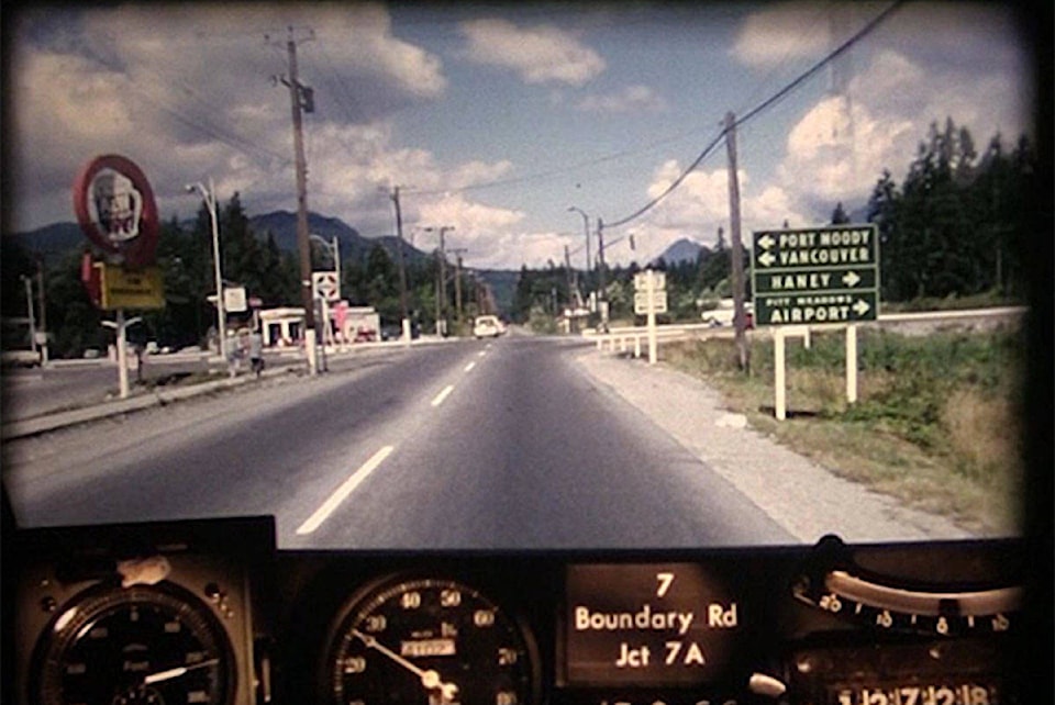
In this case, it is a fast ride down the Lougheed Highway from Burnaby, through Coquitlam to Maple Ridge, courtesy of the Ministry of Transportation and Infrastructure.
It’s a four-minute ride that shows how much has changed.
Lougheed Hwy. was two winding countryside lanes instead of four. All of the bridges have since been improved or replaced, and there are many more changes that make the rural road of 53 years ago virtually unrecognizable.
These videos are digital versions of 16 mm photo-logs collected by rigging a camera onto a car and taking still images every 80 feet or so.
Those stills were then run together as a single film to create a visual record of road condition information from across the province. This allowed ministry engineers to study a stretch of road without having to travel there.
Today, the ministry uses a specialized van called an automatic road analyzer, with computers, lasers, GPS and high definition cameras to collect information about highways and roads.
ncorbett@mapleridgenews.com
Like us on and follow us on


